UTM Simulator
OPS!
Soul Software is developing an UTM Simulator, a platform that will help to validate different UAS traffic for VLL scenarios.
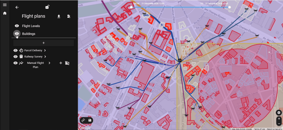
The user can create different scenarios, with custom boundaries ranging from single cities to a region.
He can add obstacles, flight rules and mission constraints (parcel delivery, railway survey)
OpenDEM data are used for the elevation info.
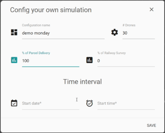
Statistics based on simulation data:
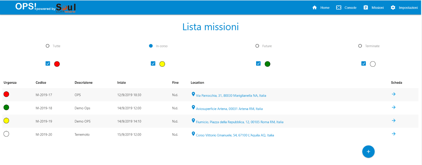
OPS! is a cloud platform with the aim of planning and managing the drone surveillance in emergency situations such as: rescue people, fire detection and fighting, natural disasters.
Local authority in charge of monitoring the territory via drones, will be able to plan the mission, assign it to a team, and monitor in real time drone movements.
A national body, delegated to control these missions, will be able to monitor events throughout the territory and will have a summary dashboard of current and past events at its disposal.
Cloud platform for planning, execution and monitoring missions and related operations.
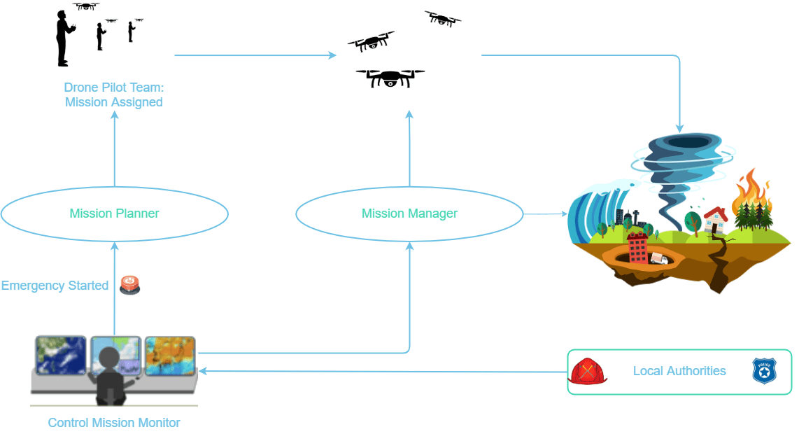

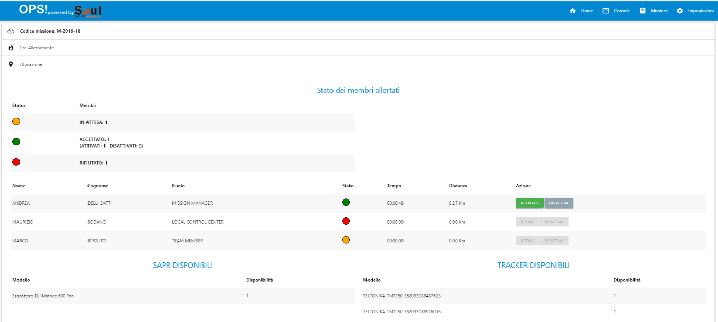
Specific missions can be created from the Operations Center, detailing some parameters such as:
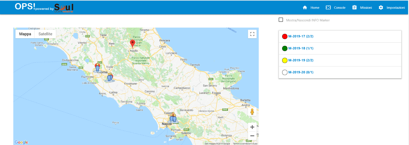
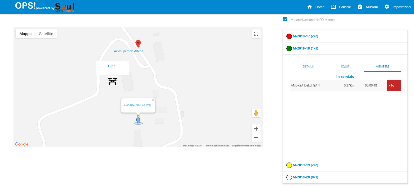
Active missions are monitored from the Operations Center through a special Console, with the aid of a digital map the locations of the operators are displayed as well as contextualized information of the ongoing missions

We need Drone Operators willing to provide us with indications, requirements and… field tests!!
| Cookie | Duration | Description |
|---|---|---|
| pll_language | 1 year | This cookie is set by Polylang plugin for WordPress powered websites. The cookie stores the language code of the last browsed page. |
| Cookie | Duration | Description |
|---|---|---|
| cookielawinfo-checkbox-funzionali | 1 year | No description |